
Circulation Element
Circulation Element
Section titled “Circulation Element”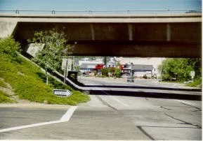
I-5 overpass leading to Main Street
2.1. Introduction
Section titled “2.1. Introduction”LEGAL BASIS & REQUIREMENTS
Section titled “LEGAL BASIS & REQUIREMENTS”The legal requirements of the general plan circulation element are defined in Government Code Section 65302(b) as follows:
“[The general plan shall include] a circulation element consisting of the general location and extent of existing and proposed major thoroughfares, transportation routes, terminals, and other public utilities and facilities, all correlated with the land use element of the plan.”
The Circulation Element provides a framework to guide transportation planning throughout the City of Yreka and its sphere of influence. Goals and programs provide direction for maintaining and improving Yreka’s transportation systems. In addition, this element assesses the current circulation conditions in the area and analyzes improvements to support new development anticipated within the Land Use Element of the General Plan. Public utilities are addressed in the Public Facilities Element.
OVERVIEW
Section titled “OVERVIEW”Interstate 5 is how most visitors and residents enter and leave the City of Yreka. The City has three primary entry points from Interstate 5 that are located at Moonlit Oaks Drive, Miner Street/Center Street and Montague Road. All three interchanges provide access to State Route 3 (SR 3) because Main Street is State Route 3. There are also several other connections to the City from County roads, most notably Oberlin to the east and Westside Road to the south and Greenhorn Road to the west.
REGIONAL SETTING
Section titled “REGIONAL SETTING”The City is located in northern Siskiyou County and is served by Interstate 5, State Routes 3 and 263, and A12 (Grenada) to State Highway 97 (See Figure 1.1). Within the City, there are a number of significant roadways, including Main Street, Oregon Street and Miner Street that provide internal circulation and connection to the Siskiyou County Roadway system. Within and around the City are numerous power, telephone and gas lines that provide public utilities.
Yreka is served by a variety of State and County roads with Interstate 5 being the most significant highway affecting the City. Interstate 5, traversing in a north-south direction, bisects a portion of the City and provides access to Yreka at the north, central and south interchanges. Interstate 5 provides easy access to Yreka, the County seat for Siskiyou County, from both the north and south sections of the County. State Route 3, which provides access from Scott Valley to the southwest and from Montague to the east, traverses the full length of Yreka following Main Street and Montague Road. State Route 263 provides access to Yreka from the Klamath River area and ends at its intersection with SR 3 (Main Street) in Yreka.
(Table 2-1)
Significant Siskiyou County roads serving the Yreka area are: Old Highway 99 to the south, Oberlin Road to the east and Yreka/Ager Road to the northeast. Other County roads lie within the Planning Area but primarily serve local traffic and carry low volumes of traffic. (Table 2 - 1)
Siskiyou County Local Transportation
Commission (LTL) is in the process of developing a regional transportation plan including a 5 to 20year highway improvement schedule. Yreka is a member of the Commission and will participate in decisions affecting transportation improvements in the Planning area.
ROAD STANDARDS AND CLASSIFICATIONS
Section titled “ROAD STANDARDS AND CLASSIFICATIONS”Roads are classified into different types depending on the type and amount of traffic they are designed to accommodate. Large roadways, handling high volumes of traffic need more right of way and larger intersections. The City of Yreka has three main road classifications: Arterial, Collector and Local, with many different variations of these major road types. Table 2-2 defines each road type and includes local, significant local, culde-sac and private streets. In many instances the difference between a road classification is subtle, amounting to the physical links that the road provides to other routes, or the types of land use along the road.
Figure 2-1 illustrates the typical right of way widths for each roadway classification. The widths should be considered a “typical” size, with a large range of width possible depending on topography, existing development and intersection needs.
2.2. Roadway Network
Section titled “2.2. Roadway Network”ARTERIALS
Section titled “ARTERIALS”State Route 3/Main Street serves as the main arterial north/south route through Yreka. In addition, Interstate 5 parallels Main Street and provides service to both regional and local traffic. Main Street connects all three of Yreka’s I-5 Interchanges, historic downtown, and the commercial areas at both the north and south end of the community. Because of its location and uses located along its length, it carries the heaviest traffic load. The width of this arterial varies from two to four lanes, with a continuous left turn lane on most of its length from Oberlin to Montague Roads.
Oberlin Road carries moderately heavy traffic at a high speed and connects rural Siskiyou County east of Yreka with industrial and housing areas east of I- 5. Additionally, the connections between Main Street and I-5 at the central and southern exits (Miner, Center and Moonlit Oaks) should be considered as arterial streets along with SR 263. (Table 2-1)
COLLECTORS
Section titled “COLLECTORS”Collector streets include: North and South Oregon Street, Fairlane Road, Foothill Road, Westside Road, West Oberlin Road and Miner Street between Main
Street and Gold Street. Tebbe Street between North Main Street and North Oregon Street and 4-H Way connecting South Oregon with South Main Street should also be considered as collectors. All of these collector streets carry a moderately heavy traffic volume, serving large areas with heavy traffic generators such as schools, businesses, offices and industry. (Table 2 -1)
+-------------------------------------------------------------------------------------------------------------+ | 2. CIRCULATION | | | | Table 2-1 - Existing Roadway Classifications | | | | +--------------------------------------+----------------------------------+-------------------------------+ | | | Arterial | Collector | Significant Local Streets | | | +:=====================================+:=================================+:==============================+ | | | Main Street | Oregon Street | Jackson Street | | | | | | | | | | State Route #3 | Fairlane Road | French Street | | | | | | | | | | State Route #263 | Foothill Drive | Moonlit Oaks Avenue | | | | | | | | | | East Oberlin Road | Miner Street (East) | Evergreen Lane | | | | | | | | | | Freeway connections to Main Street | Westside Road | Lane Street | | | | | | | | | | | 4-H Way | Miner Street | | | | | | | | | | | Tebbe Way | Yama Street | | | | | | | | | | | W. Oberlin Road Greenhorn Road | Lennox Street | | | | | | | | | | | Phillipe Lane | Knapp Street | | | | | | | | | | | | Shasta Avenue | | | | | | | | | | | | Discovery Street | | | | | | | | | | | | North Street | | | | | | | | | | | | Wetzel Way | | | | | | | | | | | | Terrace Drive | | | | | | | | | | | | Fairchild Street | | | | | | | | | | | | Lawrence Lane | | | | | | | | | | | | Fourth Street | | | | | | | | | | | | Campus Drive | | | +--------------------------------------+----------------------------------+-------------------------------+ | | | | ^1^ All streets not listed in Table 2.1 are designated as Local | +=============================================================================================================+
SIGNIFICANT LOCAL STREETS
Section titled “SIGNIFICANT LOCAL STREETS”Many of Yreka’s streets are considered to be significant local streets that are typically the shortest route to an arterial, collector, schools and businesses with few stops required. Traffic on these streets fall well below normal collector standards with volumes, which are expected to be less than 1500 vehicles per day. Typically, these streets also have standard residential roadway widths. The east-west roads in this category are: Greenhorn Road, Lawrence Lane, Evergreen Lane, Jackson Street/French Street, Lane Street, Miner Street west of Gold Street, Yama Street, Lennox Street, and Knapp Street. Discovery Street, Fairchild Street and Shasta Avenue have similar vehicular carrying characteristics in a north-south direction. The eventual connection of Discovery to the northeast to North Main Street would also fall into this category, as would potential
connections between Campus Drive and SR 3. All other streets not otherwise specified herein are considered to be local streets. (Table 2-1)
INDUSTRIAL
Section titled “INDUSTRIAL”Phillipe Lane, Oberlin Road, Foothill Drive, Fairlane Road, Greenhorn Road and South Oregon Street between Payne Lane and 4-H Way represent roads that carry significant industrial traffic.
COMMERCIAL
Section titled “COMMERCIAL”Main Street, Miner Street, Broadway Street, South Oregon Street, Moonlit Oaks Avenue, Foothill Drive, Montague Road and Fort Jones Road represent those streets that serve most of Yreka’s commercial businesses.
PRIVATE
Section titled “PRIVATE”Developers occasionally request private streets in their projects in order to provide a different width or design matching that of the development.
Unfortunately, despite the best intentions of the developer and homeowners, private roads are seldom maintained properly and typically fall into disrepair. Once owners are faced with the task and high cost of rebuilding a road that may have been built to a lower standard than a public street, they often request that the City “accept the roadway” into the publicly maintained road system.
Roadways must meet vigorous design, testing and construction standards before they can be accepted by the City into the publicly maintained road system. Private roads seldom meet these standards. In order to avoid this conflict, the City may require that the travel way and parking areas of private roads be constructed to the same engineering standard as conventional public streets. This still allows flexibility in right of way width, whether there are sidewalks, etc., but protects both the residents and the City from future requests to accept a substandard roadway. Nothing in the General Plan or City codes is designed to restrict or prohibit private streets, only to ensure that design, rather than lower cost of construction, is the goal of the private street.
LEVEL OF SERVICE
Section titled “LEVEL OF SERVICE”The Level of Service (LOS) is a measure of traffic service along a road or at an intersection. LOS ratings range from A through F, with LOS A, B and C indicating traffic can move relatively freely. LOS D describes conditions where delay is more noticeable and average traffic speeds are low. LOS E indicates significant delays and average speeds of one-third the free flow speed or lower. LOS F is characterized by traffic flows at very low speeds (stop and go) and long delays (more than one minute). (Table 2-3)
The Level of Service is used to evaluate how busy a street or intersection is, and to establish priorities for improvement. The level of service can also be used to determine whether the estimated traffic from a new project might overwhelm existing improvements. Most communities establish a level of service that reflects some of the impacts of modern life---increased traffic. By establishing a threshold for the Level of Service at “C”, the City is ensuring that improvements to the roadways are “reasonable” and affordable.
MEASURING TRAFFIC CONGESTION AND TRAVEL
Section titled “MEASURING TRAFFIC CONGESTION AND TRAVEL”In 2013, Governor Jerry Brown signed Senate Bill (SB) 743, which changed the way impacts to our transportation systems are analyzed under the California Environmental Quality Act (CEQA). In California, all projects, whether public or private, requiring a discretionary approval trigger the CEQA review process, unless otherwise determined to be exempted. The objective of this process, in part, is to identify significant environmental impacts, including those from transportation impacts in order to ensure safety and efficiency of the roadway network as new development occurs. Transportation systems have major environmental impacts, both in their construction and utilization. By understanding and analyzing how new development may affect an existing transportation system, the City can better plan for and mitigate potential negative impacts, ensuring safety, mobility, and accessibility.
SB 743 intends to better balance the needs of congestion management more appropriately with statewide goals related to infill development, promotion of public health through active transportation (walking, biking, etc.), and reduction of greenhouse gas emissions.
For the past several decades, project impacts to a circulation system were measured under CEQA by using Level of Service (LOS) thresholds. As discussed above, LOS functions as a measure of congestion or roadway capacity by assigning a letter grade (A = high capacity or low congestion, through F = no capacity, high congestion) to intersections or roadway segments based on the ability to carry a pre-determined level of traffic. SB 743 shifted the metric from LOS to Vehicle Miles Traveled (VMT) thresholds. VMT does not directly measure traffic operations but instead is a measure of network use or efficiency. The VMT metric measures the total miles traveled by vehicles as a result of a given project. Typically, development at a greater distance from other land uses, and development located in areas with poor access to non-auto modes of travel, will
generate more driving than development located proximate to other complementary uses. Thus, VMT will most always be higher where transportation options other than the personal automobile are limited, such as in rural towns.
This can pose an issue in rural towns where land uses are located at greater distances apart. A person in a rural town will typically have to drive a greater distance to get from home to school to a town center versus a person in a densely populated urban area with vertical development and a greater mix of land uses in close proximity.
The intent of shifting from LOS to VMT is to increase infill development, promote public health through active transportation (walking, biking), and reduce greenhouse gas emissions by decreasing vehicle miles driven. In April of 2018, the State Office of Planning and Research (OPR) updated the CEQA statute, produced Technical Guidelines, and gave California cities a July 1, 2020 deadline to begin implementing the new law. This implementation deadline required local jurisdictions to begin using VMT instead of Level of Service (LOS) to analyze transportation impacts under (CEQA). To do this, cities generally need to replace current General Plan policies and programs that address LOS with new policies and programs addressing VMT when measuring transportation impacts from a project.
Transportation Impact Threshold: VMT
In order for the CEQA analysis to be meaningful, there must be a baseline and a significance threshold against which project impacts are evaluated. CEQA Guidelines section 15064.7(a) defines a threshold of significance as “an identifiable quantitative, qualitative or performance level of a particular environmental effect”. Exceeding the threshold means the impact will be determined to be significant. Conversely, not exceeding the threshold means the impact will be determined to be less than significant.
In this case, a VMT significance threshold establishes what amount of VMT change would be considered unacceptable such that a significant impact would occur that requires mitigation. Selecting a threshold is difficult as VMT growth is directly related to population growth, employment growth and increased economic activity; all of which are attractive things cities generally wish to encourage. Additionally, VMT is the outcome of individual decisions regarding methods to access destinations such as employment, education, medical treatment, food purchase, etc.; therefore, it is largely up to individuals to reduce their VMT by their own accord.
Section 21099 of the Public Resources Code states that the criteria for determining the significance of transportation impacts must promote: (1) reduction of greenhouse gas emissions; (2) development of multimodal networks; and (3) a diversity of land uses. While OPR’s Technical Advisory is not binding on public agencies, a significance threshold for the City should be selected that aligns with state law on all three of the criteria.
OPR’s Technical Advisory on Evaluating Transportation Impacts in CEQA recommends the following thresholds be used for land use projects:
-
Residential projects — A proposed project exceeding a level of 15 percent below existing (baseline) VMT per capita may indicate a significant transportation impact. Existing VMT per capita may be measured as regional VMT per capita or as city VMT per capita.
-
Office projects — A proposed project exceeding a level of 15 percent below existing (baseline) regional VMT per employee may indicate a significant transportation impact.
-
Retail projects — A net increase in total VMT may indicate a significant transportation impact.
The OPR recognizes that areas outside of metropolitan planning areas, especially rural counties, have fewer options for reducing VMT. As such, while the State’s overall goal with SB 743 is to promote denser infill development, reduce reliance on individual vehicles, and improve mass transit systems in order to reduce greenhouse gas emissions, the new requirements may pose more of an impediment to development rather than encouraging it. If development projects are unable to meet the goals of the state, there may be a reduction in overall development.
Projects that cannot demonstrate a 15 percent or higher reduction in VMT will be required to conduct additional analysis and add mitigation as appropriate. If project design or operational features cannot reduce VMT below the threshold, an EIR may be required in order for the City to consider a statement of overriding considerations.
Within the planning area, strategies to reduce VMT are limited due to the low-density land use pattern and reliance on private vehicles. Typically, Transportation Demand Management (TDM) strategies are intended to reduce the number of miles driven in a single car and focus on public transit alternative modes of transportation. The following strategies may be best suited to the region and are recommended to reduce VMT and lessen significant impacts:
-
Increase diversity of land uses
-
Provide pedestrian network improvements
-
Provide traffic calming measures and lowstress bicycle network improvements
-
Increase transit service frequency and speed
-
Encourage telecommuting and alternative work schedules
-
Support ride-sharing opportunities
Additionally, although no longer legally allowed for use to measure CEQA transportation impacts, LOS analysis will still be used by the City as a determinant to assess capacity and operational deficiencies of City roadways.
Table 2-2 - City of Yreka Road Classifications
+-------------------------+-----------------------------------------------------------------------------------------------------------------------------------------------------------------------------------------------------------------------------------------------------------------------------------------------------------------------------------------------------------------------------------------------------------------------------------------------------------------------------------------------------------------------------------------------------------------------------------------------------------------------------------------------------------------------------------------------------------------------------------------+ | Road Type | Definition | +:========================+=========================================================================================================================================================================================================================================================================================================================================================================================================================================================================================================================================================================================================================================================================================================================================+ | Arterial | Arterial streets provide the major travel corridors through Yreka, linking Collector streets with regional roadways. Arterials connect with both Residential Local and Collector streets. Arterials are designed to carry the greatest traffic volumes. Right of Way requirements for Arterials range between 80 and 100 feet with 84 feet being typical. | +-------------------------+-----------------------------------------------------------------------------------------------------------------------------------------------------------------------------------------------------------------------------------------------------------------------------------------------------------------------------------------------------------------------------------------------------------------------------------------------------------------------------------------------------------------------------------------------------------------------------------------------------------------------------------------------------------------------------------------------------------------------------------------+ | Collector/ Industrial | Collector streets provide a linkage between Local streets and Arterial streets. Collector streets serve a variety of functions, providing access to residential and nonresidential properties and allowing movement to and from Local streets. Collectors carry light to moderate traffic volumes. Right of Way requirements for this type of street range between 60 and 80 feet with 64 feet being typical. | +-------------------------+-----------------------------------------------------------------------------------------------------------------------------------------------------------------------------------------------------------------------------------------------------------------------------------------------------------------------------------------------------------------------------------------------------------------------------------------------------------------------------------------------------------------------------------------------------------------------------------------------------------------------------------------------------------------------------------------------------------------------------------------+ | Significant | Significant local streets are those streets that do not have high enough traffic volumes to be considered a collector, but are typically the shortest route to an arterial, collector, schools or businesses. These streets may have little to distinguish them from other Local Streets except fewer stop signs and controlled intersections. A few north-south streets have these characteristics, but have shorter lengths, making northsouth trips in westerly Yreka more time consuming. Right of way for Significant Local Streets is typically 60 feet. | | | | | Local Street | | +-------------------------+-----------------------------------------------------------------------------------------------------------------------------------------------------------------------------------------------------------------------------------------------------------------------------------------------------------------------------------------------------------------------------------------------------------------------------------------------------------------------------------------------------------------------------------------------------------------------------------------------------------------------------------------------------------------------------------------------------------------------------------------+ | Local | Residential Local streets provide direct access to adjacent properties and are not intended to serve through traffic. Local streets provide access to Collector streets and carry low traffic volumes. | +-------------------------+-----------------------------------------------------------------------------------------------------------------------------------------------------------------------------------------------------------------------------------------------------------------------------------------------------------------------------------------------------------------------------------------------------------------------------------------------------------------------------------------------------------------------------------------------------------------------------------------------------------------------------------------------------------------------------------------------------------------------------------------+ | Cul-de-sac | Cul-de-sac streets are popular with homeowners for a variety of reasons, such as privacy and low traffic. With only one way in and out, the number of homes on the culde-sac is a safety concern for fire and police should evacuation be necessary. There are a number of design solutions that can address the access and safety issue, these include larger entries, emergency secondary access, design of homes, etc. Because topography and design differ in each project, the City will need review each project individually. The right of way width for a cul-de-sac is typically a 50- foot radius, although the width may be changed to meet safety or access concerns. Maximum length of a cul-de-sac is typically 600 feet. | +-------------------------+-----------------------------------------------------------------------------------------------------------------------------------------------------------------------------------------------------------------------------------------------------------------------------------------------------------------------------------------------------------------------------------------------------------------------------------------------------------------------------------------------------------------------------------------------------------------------------------------------------------------------------------------------------------------------------------------------------------------------------------------+ | Private | These roads are not owned or maintained by the City and are usually part of a large development project. While these roads may be very low volume, in large projects they may be of any size as needed to meet traffic demand. Each road width is reviewed with the specific project requesting the roadway. | +-------------------------+-----------------------------------------------------------------------------------------------------------------------------------------------------------------------------------------------------------------------------------------------------------------------------------------------------------------------------------------------------------------------------------------------------------------------------------------------------------------------------------------------------------------------------------------------------------------------------------------------------------------------------------------------------------------------------------------------------------------------------------------+
Figure 2.1
City of Yreka
Typical Street Sections

Typical Street Sections
Distance in Feet
+----------------------------+-------+-----+------+---+-----+------+------------+ | Designation | R x 2 | R | U | S | P | T2 | T1 | +:===========================+:======+:====+:=====+:==+:====+:=====+:===========+ | Arterial | 84 | 42 | 3 | 7 | 8 | 12 | 12 | +----------------------------+-------+-----+------+---+-----+------+------------+ | Collector/Industrial | 64 | 32 | 3 | 7 | 10 | 12 | - | +----------------------------+-------+-----+------+---+-----+------+------------+ | Significant Local Street | 60 | 30 | 5 | 5 | 8 | 12 | - | +----------------------------+-------+-----+------+---+-----+------+------------+ | Local & Cul-de-Sac | 50 | 25 | - | 5 | 8 | 12 | - | +----------------------------+-------+-----+------+---+-----+------+------------+ | Private | 34 | 17 | - | 3 | 4 | 10 | - | +----------------------------+-------+-----+------+---+-----+------+------------+
+------------------------------+---------------------------------------+ | T1 - Travel Lane | U - Utility/Landscaping Area | | | | | T2 - Travel Lane | R - Street Half Width | | | | | S - Sidewalk | CL - Center Line of Right-of-Way | +==============================+=======================================+
PL - Property Line
The above are considered typical street sections, and may be modified as needed to meet the needs of the City and the goals of the General Plan. The City may also create new street designations as needed to respond to individual project requests. The right of way may be widened in areas for a number of reasons including turn lanes, median islands, intersection improvements, bus turnouts, etc.
+-----------+----------------------------------------------------------------------------------------------------------------------------------------------------------------------------------------------------------------------------------------------------------------------------------------------------------------------------------------------------------------------------+ | | Table 2-3 - LEVEL OF SERVICE [LOS] DEFINITIONS | +:=========:+:===========================================================================================================================================================================================================================================================================================================================================================================+ | LOS | Description | +-----------+----------------------------------------------------------------------------------------------------------------------------------------------------------------------------------------------------------------------------------------------------------------------------------------------------------------------------------------------------------------------------+ | A | Represents free flow. Excellent level of comfort, convenience and freedom to maneuver. | +-----------+----------------------------------------------------------------------------------------------------------------------------------------------------------------------------------------------------------------------------------------------------------------------------------------------------------------------------------------------------------------------------+ | B | Represents stable flow, but the presence of other road users in the traffic stream causes noticeable reductions of comfort, convenience, and freedom to maneuver. | +-----------+----------------------------------------------------------------------------------------------------------------------------------------------------------------------------------------------------------------------------------------------------------------------------------------------------------------------------------------------------------------------------+ | C | Represents stable flow, but marks the beginning of the range of flow in which operation of individual users becomes significantly affected by interactions with others in the traffic stream. | +-----------+----------------------------------------------------------------------------------------------------------------------------------------------------------------------------------------------------------------------------------------------------------------------------------------------------------------------------------------------------------------------------+ | D | Represents high density, but stable flow. Users experience severe restriction in speed and freedom to maneuver, with reduced levels of comfort and convenience. | +-----------+----------------------------------------------------------------------------------------------------------------------------------------------------------------------------------------------------------------------------------------------------------------------------------------------------------------------------------------------------------------------------+ | E | Represents operating conditions at or near the capacity level. All speeds are reduced to a low, but relatively uniform value. Freedom to maneuver is difficult, with users experiencing frustration and poor comfort and convenience. Unstable operations are frequent, where small increases or minor perturbations to the traffic flow can cause breakdown conditions. | +-----------+----------------------------------------------------------------------------------------------------------------------------------------------------------------------------------------------------------------------------------------------------------------------------------------------------------------------------------------------------------------------------+ | F | Represents traffic flows at low speeds (stop and go) and long delays (more than one minute) usually caused by a “downstream” obstruction, such as lane reduction or accident. Traffic may back up into “upstream” intersections. | +-----------+----------------------------------------------------------------------------------------------------------------------------------------------------------------------------------------------------------------------------------------------------------------------------------------------------------------------------------------------------------------------------+ | | | +-----------+----------------------------------------------------------------------------------------------------------------------------------------------------------------------------------------------------------------------------------------------------------------------------------------------------------------------------------------------------------------------------+
TRUCK TRANSPORT
Section titled “TRUCK TRANSPORT”The large truck traffic in the region is typically limited to Interstate 5, State Routes, Oberlin Road, Fairlane Road and Phillipe Lane. There are three trucking firms, one large trucking firm located on South Oregon Street and Payne Lane that generates a significant amount of traffic from that location to the south interchange with Interstate 5, a truck company, Peters, on Lucas off Greenhorn Road and Mott Brothers or Mill Road. Greenhorn Road has a lot of truck traffic at times (spring/summer/fall) with hauling of aggregate to asphalt and concrete plants. Additionally, many trucks traveling I-5 pull off the freeway at the south interchange to visit the food service businesses in that area. A truck stop is planned at the north interchange.
Within the City of Yreka truck routes have only been designated by the State on Interstate 5, State Route 3/Main Street and State Route 263. While this permits heavy truck traffic through an area of heavy commercial and tourist activity, it has not been a significant issue for the community.
COMPLETE STREETS
Section titled “COMPLETE STREETS”The California Complete Streets Act of 2008 required cities to update the Circulation Element of their General Plan to plan for a balanced, multimodal transportation network that meets the needs of all users of roadways. Complete Streets are roadways designed and operated to enable all users safe and convenient travel via all modes of transportation. Roadways developed using the principles of Complete Streets are designed to simultaneously accommodate vehicles, public transit, bicycles, and pedestrians. The idea is that providing a balanced, multimodal transportation network will serve to reduce greenhouse gas emissions, make the most efficient use of transportation infrastructure, and improve public health by encouraging physical activity via shifting short trips in an automobile to biking, walking, and the use of public transit.
The Complete Streets Act seeks to ensure that all residents, regardless of mode of travel, are provided an opportunity to use the City’s circulation network.
The Complete Streets Act does not, however, dictate a specific street design or mandate that all streets accommodate all modes of travel in the same manner. A key factor in creating a successful multimodal transportation network is making sure the planning objectives, policies, and standards reflect the rural, suburban, and/or urban context of a community within the planning area. Therefore, the City’s Complete Streets policies recognize the need to maintain design flexibility to allow for modified design standards in certain areas of the City that are consistent with the character of the neighborhood but still facilitate access by all users.
CIRCULATION GOALS & PROGRAMS
Section titled “CIRCULATION GOALS & PROGRAMS”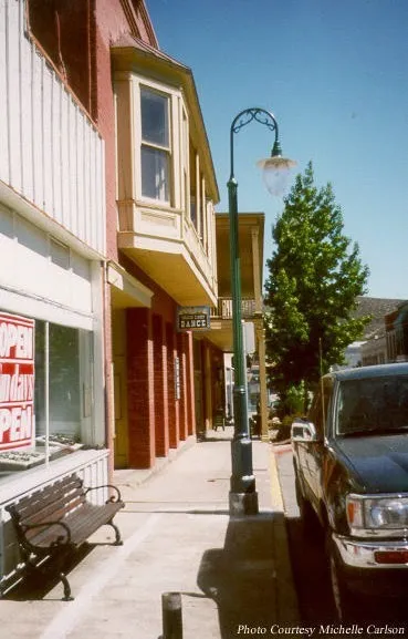 {width=“3.0290857392825896in” height=“2.7041666666666666in”}
Visually attractive building on Miner Street
Goal CI.1 — Develop and maintain roadways in an orderly and visually attractive manner that enhances the community.**
Section titled “Goal CI.1 — Develop and maintain roadways in an orderly and visually attractive manner that enhances the community.**”Objective: Roadways are typically constructed in small increments over a period of time. Without careful consideration of the long-term needs of the community, roadways might not connect, or be designed to work with each other. The City must also consider the roadway network and work to make travel within the community as efficient as possible. The objective of this goal is to keep the larger- picture in focus when reviewing new roadways and improving the existing road network.
PROGRAM CI.1.A.
Section titled “PROGRAM CI.1.A.”The City shall work to enhance the visual appearance of both pedestrian and non -vehicular routes.
PROGRAM CI.1.B.
Section titled “PROGRAM CI.1.B.”Roadways within new development projects shall be designed to allow for the extension of major and minor collector roads and local streets to adjacent future development projects.
PROGRAM CI.1.C.
Section titled “PROGRAM CI.1.C.”When practical, parking lot and service drives of adjacent commercial uses shall be designed to connect and allow traffic to travel from one commercial use to an adjacent one without using public streets.
PROGRAM CI.1.D.
Section titled “PROGRAM CI.1.D.”With consideration of street classification and function, design new streets to accommodate all modes of travel, including transit, bicycles, pedestrians and vehicles.
PROGRAM CI.1.E.
Section titled “PROGRAM CI.1.E.”Where funding, right-of-way, and physical conditions allow, retrofit and upgrade existing streets to include complete street amenities where possible and appropriate. Prioritize improvements in locations that will improve the overall connectivity of the City’s network of bicycle and pedestrian facilities or result in increased safety.
PROGRAM CI.1.F.
Section titled “PROGRAM CI.1.F.”Roadways within new development shall be designed to provide connections between and within existing and new neighborhoods for bicycles, pedestrians, and automobiles.
PROGRAM CI.1.G.
Section titled “PROGRAM CI.1.G.”Regional circulation planning shall be coordinated with Siskiyou County and the California Department of Transportation
(Caltrans).
Goal CI.2. — To maintain a functional performance of roadways throughout the community at a Level of Service C or better.**
Section titled “Goal CI.2. — To maintain a functional performance of roadways throughout the community at a Level of Service C or better.**”Objective: Using the street level of service as a measurement for assessing traffic helps to balance the subjective perception of a road being busy or “grid locked” with an objective measurement. There are few roadways in Yreka that have Level of Service (LOS) C, although some of the road segments may approach this level during peak times of the day. The objective of this goal is for LOS C to be the City minimum standard, and the design
criteria for roadway improvements. Because funding improvements often takes time, the level of service may drop below LOS C while the City is arranging financing. A temporary drop-in service is acceptable if a long-term solution is underway.
PROGRAM CI.2.A.
Section titled “PROGRAM CI.2.A.”Following adoption of this General Plan, the City shall prepare, adopt, a n d apply design standards for all classifications of roadways within the City.
PROGRAM CI.2.B.
Section titled “PROGRAM CI.2.B.”Following adoption of the General Plan, the City shall prepare a capital improvement ##### PROGRAM that identifies both roadways to be improved, and new roadways to be constructed.
PROGRAM CI.2.C.
Section titled “PROGRAM CI.2.C.”The City shall periodically review traffic volumes to ensure that adequate levels of service are maintained.
PROGRAM CI.2.D.
Section titled “PROGRAM CI.2.D.”Following adoption of the General Plan, the City shall adopt procedures to evaluate new projects and their potential impact on traffic.
Goal CI.3. — To maintain and reduce vehicle miles traveled (VMT) in accordance with SB 743 and the City’s adopted ##### PROGRAM.**
Section titled “Goal CI.3. — To maintain and reduce vehicle miles traveled (VMT) in accordance with SB 743 and the City’s adopted ##### PROGRAM.**”PROGRAM CI.3.A.
Section titled “PROGRAM CI.3.A.”Future projects exceeding a level of 15% below existing Countywide VMT per capita may indicate a significant transportation impact.
• The Baseline Countywide VMT per capita is 12.33. Recommended threshold is 15% below the existing baseline, or 10.48
PROGRAM CI.3.B.
Section titled “PROGRAM CI.3.B.”Periodically update VMT baselines and thresholds of significance, as established in the City’s VMT Policy, for evaluating transportation impacts under CEQA pursuant to SB 743.
2.3. Roadway Improvement Standards
Section titled “2.3. Roadway Improvement Standards”Figure 2-1 represents the roadway designations and rights of way expected for newly created roads and improved roadways in Yreka. The rights of way are shown as a range, because existing impediments, such as buildings, trees, slope, etc., can result in a need to alter the right of way width. Usually, there is an additional five to ten feet beyond the “road” that is used for utilities, landscaping, lights, fire hydrants and similar improvements. By allowing the right of way to be “flexible”, the City can best determine the amount of dedication required during new development, and the extent of construction for existing road improvements.
BACKGROUND
Section titled “BACKGROUND”Development standards are necessary to ensure roadway improvements within existing and future development meet the various needs of the community. These standards provide for community character, sense of place and contribute to the functionality of the circulation system. General road layout, drainage facilities, sidewalks and parking provisions are important aspects of roadway design. Additionally, mechanisms are required to ensure that new development projects provide for required road improvements, both on-site and off-site.
STREET LAYOUT DESIGN
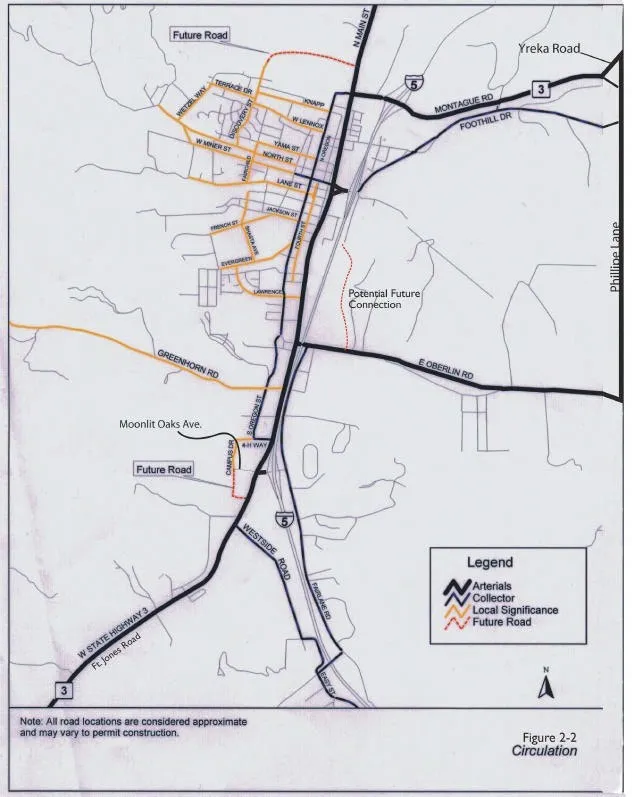
Section titled “STREET LAYOUT DESIGN”Much of the City’s existing street system follows a modified grid approach, with a more irregular system resulting where terrain dictates the need for a curvilinear system to reduce street grades and slopes by following the natural contours. While the City’s traditional grid system allows for through movement and good connection between neighborhoods, the addition of a through north- south “significant local street” in the western section of Yreka would improve traffic movement in that area. Figure 2-2 - Conceptual Street Layout depicts how the existing grid street pattern can be extended to new development.
PARKING
Section titled “PARKING”Adequate vehicle parking is required to support existing and future development within the City. The placement and type of parking must accommodate the needs of businesses who view parking as a marketing tool; pedestrians who can view parking as a barrier when it blocks walking paths; motorists who want to park as close to their destination as possible; and, residents who desire both on and off street parking.
Within all types of land uses, on -site parking is required to provide for the majority of the parking demand created by the use. Specific parking requirements are established by City Ordinances.
2.
 {width=“6.583333333333333in” height=“8.302082239720034in”}
ROADWAY IMPROVEMENT GOALS & PROGRAMS
Section titled “ROADWAY IMPROVEMENT GOALS & PROGRAMS”Goal CI.4. - Accomplishment of on-going maintenance of roadways in an efficient and cost-effective manner.**
Section titled “Goal CI.4. - Accomplishment of on-going maintenance of roadways in an efficient and cost-effective manner.**”Objective: The roadway system is an essential component of the City infrastructure. All roads have a useful life that can be lengthened by appropriate maintenance or shortened by a variety of factors. The objective of this goal is to help the City maintain its road network as efficiently as possible. Because of the nature of how roadways are built, maintained and reconstructed, which roads should be “fixed” is not always intuitive. Occasionally fairly new roads must be maintained, while roads in poorer condition are left until sufficient funds are available to correct the problem.
PROGRAM CI.4.A.
Section titled “PROGRAM CI.4.A.”The City shall establish a comprehensive and cost-effective strategy for identification of road maintenance and improvement projects.
Goal CI.5. - Ensure that circulation improvements are adequate to serve transportation demands of new development within Yreka.**
Section titled “Goal CI.5. - Ensure that circulation improvements are adequate to serve transportation demands of new development within Yreka.**”Objective: The objective of this goal is to ensure that new roadways are sized appropriately for both existing and reasonably expected future growth. New roads may be phased to address the new demand with final-width improvements deferred until demand or other construction warrants the improvement. The decision to defer any improvement is solely at the discretion of the City.
PROGRAM CI.5.A.
Section titled “PROGRAM CI.5.A.”New development projects shall dedicate adequate rights-of-way to allow for construction of roadways as designated within this element.
PROGRAM CI.5.B.
Section titled “PROGRAM CI.5.B.”New development shall generally conform to the alignments depicted in Figure 2-2 Circulation.
PROGRAM CI.5.C.
Section titled “PROGRAM CI.5.C.”The City may establish fees, assessment districts, reimbursement agreements or other mechanisms to either pay for or reimburse construction of roadways and roadway improvements.
PROGRAM CI.5.D.
Section titled “PROGRAM CI.5.D.”New development shall provide adequate off-street parking spaces to accommodate parking demands generated by the use.
PROGRAM CI.5.E.
Section titled “PROGRAM CI.5.E.”Following adoption of the General Plan, the City shall establish and adopt construction standards for all roadways.
PROGRAM CI.5.F.
Section titled “PROGRAM CI.5.F.”New development shall provide improvements as needed to avoid creating significant traffic impacts on streets surrounding the proposed project.
Traffic impacts are considered significant if they result in traffic that exceeds the “Environmental Capacity” of Average Daily Trips (ADT) as defined below:
Local: Greater than 1,500 ADT
Collector: Greater than 2,500 ADT
Arterial: Greater than 5,000 ADT
Where existing traffic levels exceed the criteria above, an increase of greater than 10% over
2. existing levels is considered a significant impact.
PROGRAM CI.5.G.
Section titled “PROGRAM CI.5.G.”All travel surfaces on private roads within a residential development, or other development that is to be maintained with a property owners association, may be required be constructed to City of Yreka design standards.
2.4. Pedestrian and Bicycle Circulation
Section titled “2.4. Pedestrian and Bicycle Circulation”The terrain and form of Yreka is favorable for bicycle and pedestrian circulation. Sidewalks exist on most streets, and most streets have sufficient width and low traffic volumes permitting their safe
use by bicyclists. This section identifies strategies for improving non -vehicular transportation in the community.
BICYCLE CIRCULATION
Section titled “BICYCLE CIRCULATION”Bicycle circulation in Yreka occurs naturally throughout the road system since traffic volumes on most streets are low. Fairlane Road is the only street with a designated bicycle route. For most of
its length, this road is very wide and has marked
lanes on both sides of the street. Other streets in the City have a designated area between the vehicle travel way and the edge of pavement of sufficient
width to accommodate bicyclists. These include
South Main Street between Oberlin Road and the
South Interchange; Montague Road from the North Interchange to the easterly City Limits; and Oberlin Road (south side) from Main Street to Yellow Hammer Street.
BICYCLE PATHWAY CIRCULATIONS
Section titled “BICYCLE PATHWAY CIRCULATIONS”Class I bicycle pathways are fully separated from any traffic lanes, either in a setback landscaped corridor adjacent to the road, or in a totally separated corridor apart from the street.
Class II bicycle pathways are within the right-of- way of streets, usually collectors and arterials. The lanes are up to seven feet wide, located
adjacent to the travel lanes with signage and a stripe on the pavement demarking the lane.
Class III bicycle pathways are shared usage of streets with no specific separation of different modes of traffic. Street signage is often used to designate a roadway as a bicycle route.
Figure 2-3- Pedestrian and Bicycle Routes, designates bicycle routes within the City which would provide the greatest benefits to bicyclists and pedestrians.
PEDESTRIAN AND BICYCLE GOALS & PROGRAMS
Section titled “PEDESTRIAN AND BICYCLE GOALS & PROGRAMS” #### Goal CI.6. - Provide safe, convenient, and attractive routes for pedestrians and bicyclists of all ages throughout Yreka.**
Objective: Safe sidewalks and bicycle paths encourage use and provide an important means of transportation. The objective of this goal is to help the City encourage new pathways and routes.
PROGRAM CI.6.A. The City should support efforts to develop a comprehensive bicycle route system within Yreka.
Section titled “PROGRAM CI.6.A. The City should support efforts to develop a comprehensive bicycle route system within Yreka.”PROGRAM CI.6.B. Pedestrian and bicycle improvements shall be prioritized in the following order:
Section titled “PROGRAM CI.6.B. Pedestrian and bicycle improvements shall be prioritized in the following order:”-
Projects which increase safety for children traveling to and from school.
-
Projects which remove barriers to handicapped individuals.
-
Projects which increase overall convenience and safety for pedestrians and bicyclists.
+-----------------------------------------------------------------------------------------------------------------------------------------------------------------------------------------------------------------------------------------------------------------------------------+
| 2. CIRCULATION |
| |
| and its tributaries. RAILROAD GOALS & PROGRAMS |
| |
|  ##### PROGRAM CI.6.D. The City should ensure that the trail system provides connectivity between schools, #### Goal CI.7. - Minimize the impacts of growth** ^shopping,\ housing\ and\ employment\ centers.^ on the Yreka Western Railroad Steam Train. |
| |
| ##### PROGRAM CI.6.E. The City may require additional setback, or purchase right of way, to permit the |
+===================================================================================================================================================================================================================================================================================+
##### PROGRAM CI.6.D. The City should ensure that the trail system provides connectivity between schools, #### Goal CI.7. - Minimize the impacts of growth** ^shopping,\ housing\ and\ employment\ centers.^ on the Yreka Western Railroad Steam Train. |
| |
| ##### PROGRAM CI.6.E. The City may require additional setback, or purchase right of way, to permit the |
+===================================================================================================================================================================================================================================================================================+
PROGRAM CI.5.C.
Section titled “PROGRAM CI.5.C.”The City should actively pursue grant funding to plan and construct pedestrian and bicycle route improvements along Yreka Creek construction of pedestrian and bicycle facilities.
PROGRAM CI.6.F.
Section titled “PROGRAM CI.6.F.”The City may develop programs to help offset the loss of land for development due to additional setback or easement through properties.
PROGRAM CI.6.G.
Section titled “PROGRAM CI.6.G.”The City may require development to dedicate right of way and/or to construct pedestrian and bicycle facilities.
2.5. Railroad
Section titled “2.5. Railroad”The Yreka Western Railroad Steam Train originates at the Yreka Station and is an attraction for tourists. There are other railroad systems running through the City of Yreka.
 {width=“2.967361111111111in” height=“2.510844269466317in”}
Yreka Western Railroad Steam Train
Objective: While a portion of the City’s industrial area has access to rail for shipping, the main rail line in the City serves the Yreka Western Railroad. The steam train is a tourist attraction that has operated since 1989. As an attraction, the City will need to be sure that development along the rail route does not jeopardize the long-term use of the tracks. The objective of this goal is to establish the rail use as existing and primary, and provide the City with the means to assess how new development will affect the railroad.
PROGRAM CI.7.A. Avoid locating land uses adjacent to the railroad tracks which will be sensitive to noise, vibration and/or hazards presented by train activity.
Section titled “PROGRAM CI.7.A. Avoid locating land uses adjacent to the railroad tracks which will be sensitive to noise, vibration and/or hazards presented by train activity.”PROGRAM CI.7.B. Pursue methods of visually screening the train corridor with vegetative barriers.
Section titled “PROGRAM CI.7.B. Pursue methods of visually screening the train corridor with vegetative barriers.”2.
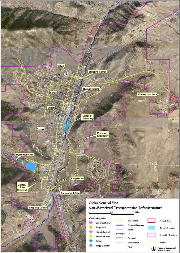
Figure 2-3 — Pedestrian and Bicycle Routes
PUBLIC TRANSIT
Section titled “PUBLIC TRANSIT”Public transit within Yreka and Siskiyou County is provided by Siskiyou Transit and General Express (STAGE) and serves the communities of the I-5 corridor, and Scott Valley. Like most rural systems, it is limited by small populations and low ridership levels. While the City will pursue opportunities to improve the level of service of public transit within the community, it will be difficult to significantly improve this situation in the near future.
PUBLIC TRANSIT SERVICES
Section titled “PUBLIC TRANSIT SERVICES”Siskiyou Transit provides public transportation by bus to Yreka and Siskiyou County residents. Service is provided with numerous schedules for the communities along I-5 as well as other communities in Siskiyou County. The busses can accommodate bicycles, and some units are wheelchair accessible.
The City also operates a Senior Bus Transportation
Service with on-call and door-to- door service.
PUBLIC TRANSIT GOALS & PROGRAMS
Section titled “PUBLIC TRANSIT GOALS & PROGRAMS”public transit. This may be as simple as providing bus turnouts or shelters, or ensuring that access drives are adequate to serve the transit vehicles.
PROGRAM CI.8.A.
Section titled “PROGRAM CI.8.A.”The City shall encourage the use of public transportation and will promote the expansion of such services within the community.
PROGRAM CI.8.B.
Section titled “PROGRAM CI.8.B.”The City will maintain dialogue with Siskiyou Transit and General Express (STAGE), the College of the Siskiyous and neighboring communities to explore options for increasing public transit services.
PROGRAM CI.8.C.
Section titled “PROGRAM CI.8.C.”The City will modify its project review process to include the Siskiyou Transit and General Express (STAGE) for larger projects, or projects in commercial and industrial areas.
PROGRAM CI.8.D.
Section titled “PROGRAM CI.8.D.”When appropriate, the City shall incorporate transit facilities, such as bus turnout, into new roadways and reconstructed roadways.
PROGRAM CI.8.E.
Section titled “PROGRAM CI.8.E.”Continue to support programs such as the Senior Bus System.

Objective: Public Transit provides an opportunity for efficient use of the roadways, reduces traffic and allows an affordable alternative to car ownership. Use of transit also helps protect air quality by reducing the number of vehicles on the roadway. The objective of this goal is to ensure that new development accommodated the needs