
Conservation, Open Space, and Parks and Recreation Element
+----------------------------------------------------------------------------------------------+
| > CHAPTER |
| > |
| > 4 |
| > |
| > ![]() {width=“2.3066666666666666in” height=“4.666666666666667e-2in”} |
| > |
| > CONSERVATION, OPEN SPACE, |
| > |
| > PARKS AND RECREATION |
+==============================================================================================+
{width=“2.3066666666666666in” height=“4.666666666666667e-2in”} |
| > |
| > CONSERVATION, OPEN SPACE, |
| > |
| > PARKS AND RECREATION |
+==============================================================================================+
4. CONSERVATION, OPEN SPACE,
PARKS AND RECREATION
LEGAL BASIS & REQUIREMENTS
RECREATION
Section titled “RECREATION”
This Element combines the Open Space and Conservation Elements. Government Cades
{width=“0.3736264216972878in” height=“0.14675524934383202in”}and 5’S302{e) requires that this
element include:
“A conserya<on elimert for the corservaCi0fli development, and utilization of
{width=“0.3736264216972878in” height=“0.10673118985126859in”}ren>urees including Waæt• and its
{width=“0.34693897637795273in” height=“9.33902012248469e-2in”}force’
{width=“0.6872058180227472in” height=“0.12007217847769029in”} rivers and ocher warers, harb0ß. fisheries. wildlife. ‘Oil’erals„ and other nacral resources.”
Government Code {65560 requires that the general plan fer open space include:
{width=“6.672134733158355e-3in” height=“6.670713035870517e-2in”}
“An open space element for chq preservation o! •and uiimal life. ieclüding haiitat for fish wile life; for the including forest ands, rangeland, ariculcural lands and of imporonce for the of food fee the enioymenz of oucdoor re:reaoon wiÜi access zo seenic r’i9er arid streams’, areas req,‘tring hazardous or special for the publié’s he;slch •rid safety,”
The general plan is required to address various open pace issues. including the preservation Of natural resources (fish and wildlife habicac), mamged production of resources (food fiber and mineral resources), outdOor recreation including aræs of scunic; historit and cultural value. and open space for health and safety.
OVERVIEW
4-1 , Yreka is a community surrounded by prominenc
4.2. visible natural resourcæ of timber and agriculture,
4.3. which over years have supported economic
{width=“6.672134733158355e-3in” height=“2.668307086614173e-2in”}development of the community. yet few natural
Soil resources are found within the City plinniag area.
Mining. ‘he initial rason the communicy was
4.1, Air developed, has long disappeared. The scenic
4.8. quality of che valley which Yreka is located, the
4.9. Open City’s gencly sloping topography and natural
4.10, drainages account for these significant resources still affecting the community. Conservation also includes the protection of air and water resources,
44
The intent of this element is not only to satisfy the requirements Of applicable Government Codes, buc also to guidelines on how impaccs co natural resourcæ are addressed within Yreka ane ics plannin; area.
4.2. Managed Resource Production
Section titled “4.2. Managed Resource Production”OVERVIEW
Section titled “OVERVIEW”The prirnary managed resources in me rural area surrounding Yreka are :imber and agricultural production. While these activities are on the periphery of community. neither Of these activities significantly affects land use wjthin Che com-munity, HistcriealCy m,ining was an Important resouree.related activicy chac ræulted the founding the city- Now the activity is limited mostly to hobbyists
{width=“1.334426946631671e-2in” height=“1.3340988626421697e-2in”}
MANAGED RESOURCES GOALS & PROGRAMS
Section titled “MANAGED RESOURCES GOALS & PROGRAMS”Goal CO. I --- Recoglize, promote and protect ete natural resources within and near the
Section titled “Goal CO. I --- Recoglize, promote and protect ete natural resources within and near the” {width=“3.0890890201224845in” height=“0.3468766404199475in”}
Objective: As evidenced by the Yreka Creek Trail. rhe Cigy can adyantage of natural drainage channels to enhance the community, These Iraiis protect habitat and link che eomrnuniey to the surrounding councrrside. The construction of trails these rouces help with maintenance and provides nc•n -motorized circulation. This type dual use turns the drainase necessity into an attractive asset. objective of fr.is goal is to recognize the need co proteec and enhance resources. and to integrate them inco new development proposals.
PROGRAM C.O.IA. Working Wich resource a’er.cies. the City shag’ evaluate eeh natural drainage and scream {o determine a building and construction setback is appropriace,
4.3. Mineral Resources
Section titled “4.3. Mineral Resources”
{width=“6.672134733158355e-3in” height=“2.668307086614173e-2in”}Historically. gold mining was responsible for che establishment of the Ciry of Yreka- Althau%h some drecge milling st.Tll takes place an the Shasta and Klamath Rivers, well as a amount Of panning for ROId. the resource is essentially depleted* and no longer plays direcc role in Yreka’s economy. Gold does provide a tourist draw to the City and che region for many amateur sold•seekers,
{width=“6.672134733158355e-3in” height=“1.3340988626421697e-2in”}
The State Mining and Geology Board has the
{width=“0.1868132108486439in” height=“0.14675524934383202in”}
Mining within Yreka would be subject to approval by the City. Eüsed upon the benefits and impacts to the Ciey. Mining may occur on surrounding County land, buc a use Perrmic and Reclamation Plan is required.
Given the lack of known commercial grade minera, deposits, impacts assocjaced with largescale mining and the investment required to iniciare operacians, it is not likely that miring will be a s;gnificant industry wichin the plann:ng area Of the Cig of Yreka.
Goal CO.2 --- To ensure responsible mining and natural resource.
Objective: The Cicy does not have commercially
{width=“6.672134733158355e-3in” height=“1.3340988626421697e-2in”}viable mineral resources within the City Limits, but m.ay encounter resources within the planning area. Most Of the resources that may affe.cc Yreka will be within the jurisdictlon ai Siskiyou County
PROGRAM CO 2 A Cocrdinate “th Siskiyou County an the review Of any extraction proiect proposed for location within or near Yreka’s Planning Area, Of particular concern will be screening Miews of the mining activity from the Cty.
PROGRAM CO.2.8. No mineral, gas, or other natural resources extraction shall occur within the City limits of Yreka wiehout prior review and approval of the accigity by the City through the Conditional l,J5e Permic process.
PADGMY CO.2.C. After completion or che mineral resources swdy by the State Mining and Geology Board scheduled by May 700B or later, the General Plan shall be updaced to delineate local imporcant mineral resource sites and add goals and programs as necessary to protect the resaw-ce.
4.4. Agricultural and Timber Lands
Section titled “4.4. Agricultural and Timber Lands”There arc no lands being used for agricultural purposes within the City limits even thougn the sails covering much the City are corvsidered to be important agricultural soils when wacer is available There are some lands Within and adjacent to the Hanning Area that support limited grazing and hay production. Such lands lie primarily to the south and east of the City and are identfied on the Siskiyou County Important Farmland Map of J 99B as Farmlands of Local Importance, The County Board of Supervisors has determined that such identified land is Of •r•npcrtance to the local agricultural economy,
Some agricultural preserses exist within the Planning Area on che east side, another ad)acent to Plannint Area on the south
{width=“1.334426946631671e-2in” height=“1.3340988626421697e-2in”}
Primary crops cultivated in this area Of Siskiyou County are alfalfa. hay and other grains for consurnpeioo by cattle raised in the County, Such agricultural lands. if protected by the County. will aid the local economy and *len continue to be a source of open sp«e and rural density development around che City, TO date, Siskiyou County has experienced the conversion of farmland to urban uses, which is a matter of concern in che State overall. Expansion Of Che City to the east and south may impact cattle pasture and agricultural lands.
There are no timber lands within the Yreka Planning Area: ho.s•ever. such lindS exist on public lands to the west and south in full view of the City, This land plays an important role in the local economy and is an effective part Of che Ciey•s peripheral open space. Of particular concern iS the view shed from the City, and the potential for this view to be degraded by extensive logging and land clearing, Since the forest lanes are noc wichjn die City limits.
{width=“0.1868132108486439in” height=“0.10673118985126859in”}City will need co work closely with the California
Goal CO.3 --- To ensure continued agria,jure
 {width=“3.0557305336832896in” height=“0.36021872265966753in”}
Object/ve: New residential uses adjacent to agriculture and timoer lands can reduce its produccivity and increase the cost Of farming hr.-anse traditional farming methods may need to be altered due the proximity of homes, While a eerta;n amount of encroachment will occur as the City expands, the use of buffers and careful placement of new uses can protect the commercia: viability of these ‘ands as long as possible. The objective Of this goal is co reduce the impact of uses on agricultural lindS,
Program During the project review process, address the itnpaetS Of siting environmentally sensitive uses near areas where conflicts with agricultura•l or timber produccjon activity may occur.
PROGRAM CO, 3-8- Maintain buffer zones around areas ad existing and planned agricultural and timber processing activities. 00 not permit sensitive uses encroach within buffer zones. Such buffer zones may vary in width based upon existing and proposed uses, vegetation, and Simply topography. The buffers may be permanent. or phased construction areas.
PROGRAM CO.3C. The City will work with appropriate forest management agencies to help protect tho view shod from the City in particular the view to the ridges around the Cicy and Planning Area,
PROGRAM CO.3,D, Those lands designated by Siskiyou County on the Important Farmland Map of 1998 as Farmlands of Local Importance, while lying within the Planning Area, should be preserved for agricultural purposes.
PROGRAM CO.3.E, Those lands lying within the
Yreka Planning Area, which are located within a Williamson Act Agricultural Preserve, shall not be annexed until such time the property is no longer under a Williamson Act contract.
4.5. Soil Resources
Section titled “4.5. Soil Resources”Most of Yreka is developed on alluvial soils and consist of gravelly, clay, and sandy loams. Typically these soils have moderate shrink-swell characteristics. have slight to modcratc erosion hazard potential and contain slopes which range from 0-9 percent, Only thc Salisbury gravely clay loam md Pit clay soils in the south central area of the City is considered to have severe shrink-swell characteristics, which could affect construction practices.
The fringe of the community lies nearer the mountains with soils with less depth and greater potential for erosion due to increased slopes which range from 10-50 percent. As the vacant lands within the Older portions of the community become depleted, there is greater pressure to develop on these steeper slopes. The increased slope of these lands requires greater attention to the manner of construction that occurs, attempting to minimize the amount of soil that is disturbed.
The following table summarizes the soil characteristics of the key soils present within the Yreka planning area. (Table 4-1)
Some of the soils are classified as Class Il and Ill soils for agricultural production capability.
A Class Il soil is considered to have moderate limitations that reduce the choice of plants or require moderate conservation practices. A Class Ill soil has severe limications that reduce tho choice of plants or that require special conservation practices, or both, Given these limitations and the extent of urban development that exists, little agricultural activity exists except in the southerly portion of the Planning Area.
4.6. Biological Resources
Section titled “4.6. Biological Resources”WILDLIFE AND HABITAT OCCURRENCE
Section titled “WILDLIFE AND HABITAT OCCURRENCE”During the preparation of this General Plan, a search of the California Department of Fish and Game, Natural Heritage Division Natural Diversity Data Base (NDDB) was conducted, The detailed results of this data base search are contained within the Background Report of this General Plan.
NDDB records are organized by geographic areas consistent with U.S.G.S. quad maps. A search of the NDDB for Yreka identified the occurrence of five species or communities of special concern.
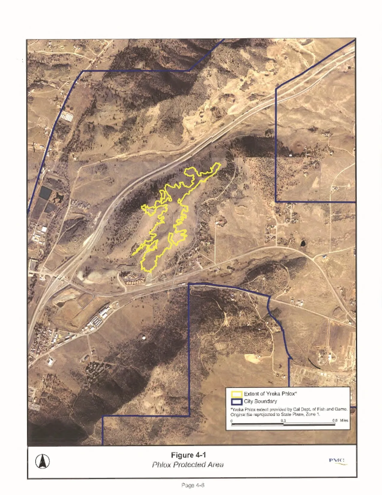
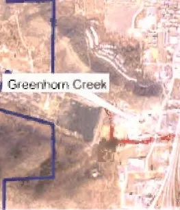
Within the City of Yreka the record search found two known locations of Yreka Phlox (Phlox hirsuta), an “endangered species” on both the federal and state lists (Figure 4-1), and the Coho Salmon (Oncorhynchus kisutch) in Yreka Creek, which is listed as “threatened” on the federal list and is a candidate for additional federal listing. Yreka Creek, from the confluence with Greenhorn Creek to the Shasta River, is a critical habitat for this species survival.
This protected plant was found between 15 and Juniper Drive at the northeastern end of the City. However, since detailed biological evaluations have generally not been conducted in and near Yreka, the lack of identified occurrences is not proof of the absence of a protected species.
Therefore, future urban development sites may require review by a qualified individual, to be approved by the City, to determine if protected habitat is present or suspected. If potential protected habitat is suspected, a biologist field survey may be required to determine whether protected plant species are present, and mitigation measures identified if protected species arc found.
4-4
Table 4-1 - Yreka Planning Area Soils
Characteristics and Limitations
+---------------------------------------------------+-----------+----------------+----------------------------------------------------------------------------------------------+
| | Rooting | > Shrink | Water-Eros ion |
| | | | |
| | | | > ![]() {width=“0.6271587926509187in” height=“0.11340223097112861in”} |
+:==================================================+:==========+:===============+:=============================================================================================+
| > #140 Dotta loam | > 2C40” | > Moderate | > Moderate |
| > | > | > | > |
| > 2-9 % slopes | > 60” | > Moderate | > Slight |
| > | > | > | > |
| > #141 Dotta gravelly loam 0-2% slopes | > 20-40” | > Moderate | > Moderate-High |
| > | > | > | > |
| > #143 Dubakella-lpish complex | > 20-40” | > Low- | > Moderate |
| > | > | > | > |
| > 5-30% slopes | > 60” | > Moderate | > Slight |
| > | | > | > |
| > #145 Dumps (dredging material) | | > ModerateHigh | > Moderate-High |
| > | | > | > |
| > #146 Duzel gravelly loam | | > Moderate | > Slight |
| > | | > | > |
| > 5-9% slopes | | > ModerateHigh | > Slight |
| > | | > | > |
| > #206 Pit clay | | > Low | > Moderate |
| > | | > | |
| > 0-2% slopes | | > Low | |
| > | | | |
| > 3 Rock outcrop -Dubakella complex 30-50% slopes | | | |
| > | | | |
| > #219 Salisbury gravelly clay loam 0-5% slopes | | | |
| > | | | |
| > #230 Stoner gravelly sandy loam | | | |
| > | | | |
| > 2-5% slopes | | | |
| > | | | |
| > #23 1 Stoner gravelly sandy loam | | | |
| > | | | |
| > 5-15% slopes | | | |
+---------------------------------------------------+-----------+----------------+----------------------------------------------------------------------------------------------+
{width=“0.6271587926509187in” height=“0.11340223097112861in”} |
+:==================================================+:==========+:===============+:=============================================================================================+
| > #140 Dotta loam | > 2C40” | > Moderate | > Moderate |
| > | > | > | > |
| > 2-9 % slopes | > 60” | > Moderate | > Slight |
| > | > | > | > |
| > #141 Dotta gravelly loam 0-2% slopes | > 20-40” | > Moderate | > Moderate-High |
| > | > | > | > |
| > #143 Dubakella-lpish complex | > 20-40” | > Low- | > Moderate |
| > | > | > | > |
| > 5-30% slopes | > 60” | > Moderate | > Slight |
| > | | > | > |
| > #145 Dumps (dredging material) | | > ModerateHigh | > Moderate-High |
| > | | > | > |
| > #146 Duzel gravelly loam | | > Moderate | > Slight |
| > | | > | > |
| > 5-9% slopes | | > ModerateHigh | > Slight |
| > | | > | > |
| > #206 Pit clay | | > Low | > Moderate |
| > | | > | |
| > 0-2% slopes | | > Low | |
| > | | | |
| > 3 Rock outcrop -Dubakella complex 30-50% slopes | | | |
| > | | | |
| > #219 Salisbury gravelly clay loam 0-5% slopes | | | |
| > | | | |
| > #230 Stoner gravelly sandy loam | | | |
| > | | | |
| > 2-5% slopes | | | |
| > | | | |
| > #23 1 Stoner gravelly sandy loam | | | |
| > | | | |
| > 5-15% slopes | | | |
+---------------------------------------------------+-----------+----------------+----------------------------------------------------------------------------------------------+
ummarized from Soil urvey o is iyou County repared y nite States Department o ricu ture and oil
Conservation Service)
While most wildlife is limited in the Planning area, unique to Yreka is the presence of many deer. Herds roam much of western Yreka, having reasonably adapted to the urban mvironment, finding shelter on vacant lots and food on residential lots not protected with adequate fencing. (It is not uncommon to see deer casually walking on Miner Street in downtown Yreka). Easy access to the mountains to the west gives these herds a range of habitat options,
NATURAL DRAINAGE CHANNELS
Section titled “NATURAL DRAINAGE CHANNELS”Wildlife habitat exists along portions of the natural drainage ways within the City. In particular are Yreka Creek, Greenhorn Creek, Humbug Creek and Juniper Creek, While much Of this creek habitat is heavily urbanized, significant portions have light to heavy vegetation and are still left in a near natural condition.
4-5
 {width=“8.5in” height=“10.987666229221347in”}
Drainage way management and incorporation Of drainage channels in future development presents a si%nifieant challenge co the City, While drainage channels present an opportunity to restore segments natural habitat, the primary function of such channels is to convey stcrrn runoff As such, vegetation assc&ted with habitat may conflict with the primary use the channels, Concerns also center the difficulty of maintaining channels an urban setting, primarily due to increased liuering and refuse dumping in and near such channels,
Futvre development 10 natural drainage ways should be required to incorporave che habitat into the project design,
The Yreka Greenway project is an exce!lenc example of how a drainage facility can function as a natural habitat. handle flood waters and provide far human use with the presence of crai15 and picnic facilities {Figure 4•2).
BIOLOGICAL RESOURCES GOALS & PROGRAMS
Section titled “BIOLOGICAL RESOURCES GOALS & PROGRAMS”
{width=“6.672134733158355e-3in” height=“6.671041119860018e-3in”}
{width=“6.672134733158355e-3in” height=“2.0012029746281714e-2in”}
Goal CO.’ Minimize to WUdiTe and wildlife habiOt as new development occurs
{width=“6.672134733158355e-3in” height=“6.671041119860018e-3in”}withinYrekn.
![]() {width=“3.0757458442694663in” height=“0.2734984689413823in”}
{width=“3.0757458442694663in” height=“0.2734984689413823in”}
{width=“2.968994969378828in” height=“2.1546391076115485in”}
{width=“0.12009405074365705in” height=“0.12007327209098863in”}
{width=“4.6703849518810146e-2in” height=“0.12007327209098863in”}Objective: The City contains known
{width=“0.36028215223097115in” height=“9.33902012248469e-2in”}a’ Yreka Phlox IPhIox hirsuca), an “endangered species” on both the federal and state lists, and Coho Salmon (Oncorhynchos kisuochj in Yreka Creek listed as “chreatened’” on the féderal list and is a candidace for additional federal listing, and has worked co ensure that development does nac negatively
{width=“6.671041119860018e-3in” height=“2.668307086614173e-2in”}affect this species, The abjecive of this is to ensure chac subsequent development clearly
{width=“1.1342224409448818in” height=“0.12007327209098863in”}Appli appropriate mitigation measures ta development projects to minimize impacts to biologica• resources during and after conscruction-
PROGRAY; CO.”, g, Consider opportunities for habitat preset-vatjon and enhancement in conjunction with public facility projects, particularly storm drainage facilities. Construction activity involved in such preservation and enhancemenc shaL be
{width=“0.4937215660542432in” height=“0.10673118985126859in”}to determine pocential impacts on Coho salmon.
PROGRAM CO.4.C. Appléorvt,s for new developmmt proposals shall be responsible for
{width=“6.672134733158355e-3in” height=“1.3340988626421697e-2in”}costs related to cetermining the potential for occurrence of protected plant and wildiife species within the proposed project area. City staff shall make the determination on the degree al field Investigation req aired ha•etl che project’s location in re lacon to known occurrences.
PROCRN*I CO A.O. If the presence of protected qecies is determined to be the project applicant shall be responsibie for all casts associated wicn investigating species presence and preparation of any required mitigation plans,
4.7. Air Quality
Section titled “4.7. Air Quality”AIR QUALITY REGULATORY AUTHORITY {width=“6.672134733158355e-3in” height=“1.3340988626421697e-2in”}
Section titled “AIR QUALITY REGULATORY AUTHORITY{width=“6.672134733158355e-3in” height=“1.3340988626421697e-2in”}”The federal Clen Air Acc. adopted in 1970 and
page
+----------------------------------------------------------------------------------------------+---------------------------------------------------------------------------------------------------------------------------------------------------------------------------------------------------------------------------------------+-------------------------------------------------------------------------------------------+
| > ![]() {width=“0.22017279090113737in” height=“1.3941786964129483in”} | >
{width=“0.22017279090113737in” height=“1.3941786964129483in”} | > ![]() {width=“1.6212718722659667in” height=“0.16009733158355205in”} |
{width=“1.6212718722659667in” height=“0.16009733158355205in”} | 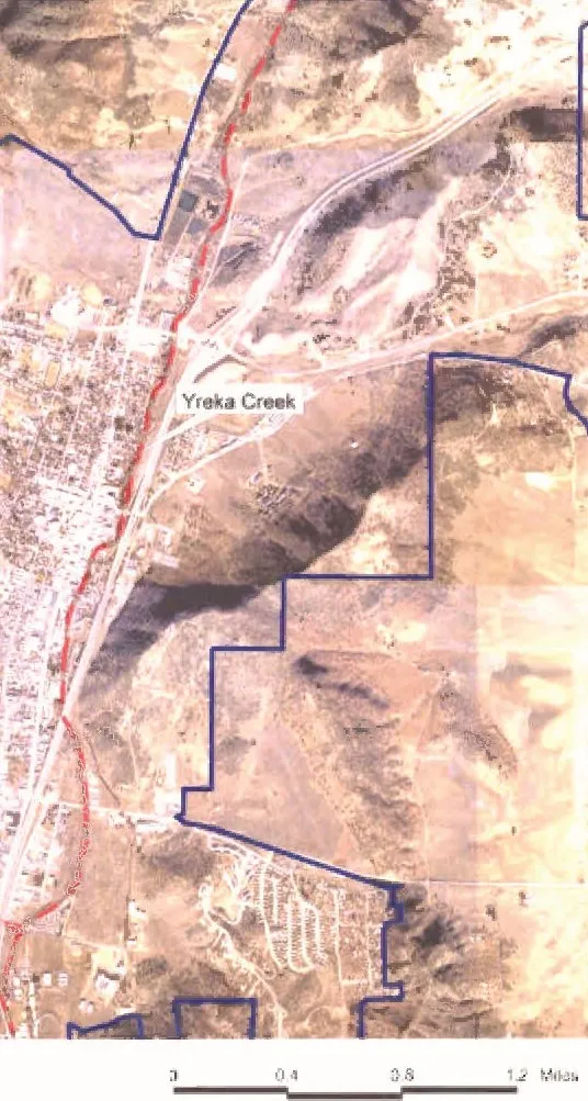 {width=“3.5761384514435695in” height=“6.6907228783902015in”} |
| +---------------------------------------------------------------------------------------------------------------------------------------------------------------------------------------------------------------------------------------+ |
| |
{width=“3.5761384514435695in” height=“6.6907228783902015in”} |
| +---------------------------------------------------------------------------------------------------------------------------------------------------------------------------------------------------------------------------------------+ |
| |  {width=“2.7955260279965004in” height=“2.274712379702537in”} | |
| | | |
| | | |
| | | |
| | | |
+----------------------------------------------------------------------------------------------+---------------------------------------------------------------------------------------------------------------------------------------------------------------------------------------------------------------------------------------+ |
| | |
+-----------------------------------------------------------------------------------------------------------------------------------------------+--------------------------------------------------------------------------------------------------------------------------------------------------------------------------------------+ |
| | | |
+-----------------------------------------------------------------------------------------------------------------------------------------------+ | |
| >
{width=“2.7955260279965004in” height=“2.274712379702537in”} | |
| | | |
| | | |
| | | |
| | | |
+----------------------------------------------------------------------------------------------+---------------------------------------------------------------------------------------------------------------------------------------------------------------------------------------------------------------------------------------+ |
| | |
+-----------------------------------------------------------------------------------------------------------------------------------------------+--------------------------------------------------------------------------------------------------------------------------------------------------------------------------------------+ |
| | | |
+-----------------------------------------------------------------------------------------------------------------------------------------------+ | |
| >  {width=“0.5671117672790901in” height=“0.9939359142607174in”} | | |
+-----------------------------------------------------------------------------------------------------------------------------------------------+ | |
| >
{width=“0.5671117672790901in” height=“0.9939359142607174in”} | | |
+-----------------------------------------------------------------------------------------------------------------------------------------------+ | |
| >  {width=“0.5671117672790901in” height=“2.4815037182852144in”} | | |
| +--------------------------------------------------------------------------------------------+-----------------------------------------------------------------------------------------+ |
| | >
{width=“0.5671117672790901in” height=“2.4815037182852144in”} | | |
| +--------------------------------------------------------------------------------------------+-----------------------------------------------------------------------------------------+ |
| | > ![]() {width=“0.2401881014873141in” height=“2.434809711286089in”} | | |
| | +-----------------------------------------------------------------------------------------+ |
| | | | |
| | +-----------------------------------------------------------------------------------------+ |
| | |
{width=“0.2401881014873141in” height=“2.434809711286089in”} | | |
| | +-----------------------------------------------------------------------------------------+ |
| | | | |
| | +-----------------------------------------------------------------------------------------+ |
| | |  {width=“1.7547101924759405in” height=“2.04123687664042in”} | |
+-----------------------------------------------------------------------------------------------------------------------------------------------+ | | |
| | | | |
+:=============================================================================================+:===============================================+:===========================================================================================+:========================================================================================+:==========================================================================================+
|
{width=“1.7547101924759405in” height=“2.04123687664042in”} | |
+-----------------------------------------------------------------------------------------------------------------------------------------------+ | | |
| | | | |
+:=============================================================================================+:===============================================+:===========================================================================================+:========================================================================================+:==========================================================================================+
| ![]() {width=“0.9207217847769029in” height=“0.3068525809273841in”} Figure |
| |
|
{width=“0.9207217847769029in” height=“0.3068525809273841in”} Figure |
| |
|  {width=“2.508634076990376in” height=“0.34687773403324584in”}
 ![]() {width=“0.8006277340332458in” height=“0.10673228346456692in”} Gteecweay |
+----------------------------------------------------------------------------------------------------------------------------------------------------------------------------------------------------------------------------------------------------------------------------------------------------------------------------------------------------------------------------------------------------------------------------------+
{width=“0.8006277340332458in” height=“0.10673228346456692in”} Gteecweay |
+----------------------------------------------------------------------------------------------------------------------------------------------------------------------------------------------------------------------------------------------------------------------------------------------------------------------------------------------------------------------------------------------------------------------------------+
Page 4-8
The federal Clean Air Act requires Slates to submit a Scate Implementation Plan (SIP) ror areas
{width=“0.2401881014873141in” height=“0.10673118985126859in”}exceed NAAQS (such areas are referred to as “non •attainment areas”). Failure to comply with requirements for p reparing the SIP can result in denial of federal fundinc and permits for such improvements as highway construction and sewage treacrnent plants.
LOCAL AIR QUALITY MANAGEMENT AUTHORITY
Section titled “LOCAL AIR QUALITY MANAGEMENT AUTHORITY”The Cit/ of Yreka is located in a region idencified as the Northeastern Plateau Air Basin which principally includes Siskiyou, Modoc and Lassen Counties, This larger air basin is div)ded into local air districts which are with the responsibility Of implementing air quality programs. The Air Quality District respo.nsibJe for Yreka is Ghe Stskiyou County Air Pollution Coor;rol District (SCAPCD).
Within the SCAPCD. the prirr&qry source Of air pollutictl is die motor vehicle, In f’€sponse to this source of pollutants, the legislature adopted the Catfornia Clean Air Act which resuir•es local air districts to develop measures to reduce emissions from mobile sources. SCAPCD reviews land development projects as r,nrt of their CEQA process to decermine air quality
{width=“0.44034558180227473in” height=“0.14008530183727033in”}and then appay local rules as a means to mitigate air quality im.pacts from the project.
AIR QUALITY STANDARDS ATTAINMENT
STATUS FOR SISKIYOU COUNTY
Section titled “STATUS FOR SISKIYOU COUNTY”Air quality standards are sec at both the stace and federal levels of government When che polutants within an area are che allowed standards. that area is considered to be in attainment with the standards.
Yreka ane Siskiyou County do not have significant air quality problems and is eonsidered to have attained all Federal and State Air Quality Scandards except PM PM 10 typically pariculate matter from Slash buming. woodstoves. and sonilar activities.
AIR QUALITY STANDARDS GOALS & PROGRAMS
Section titled “AIR QUALITY STANDARDS GOALS & PROGRAMS”Goal CO.5 Maintain and protect air quality within the City of Yreka at accepuble levels as defined by nte and {width=“1.1742541557305337in” height=“0.12007217847769029in”}
Section titled “Goal CO.5 Maintain and protect air quality within the City of Yreka at accepuble levels as defined by nte and{width=“1.1742541557305337in” height=“0.12007217847769029in”}”Objective: Mosc Of the air quality issues in
Siskiyou County refect the rural nature of +e County and agrieuIeuaJI industry. The County is sparsely populated and is in compliance with most of the federal and state air quality standards. The one exception is PMIO is usually from burring (either voluntary or ‘Orest fire) or dusc from grading or plowing. The objective of this goal is to work with developmenc to ensure that their contribution to this air quality problem is kept as low as possible,
{width=“0.49372047244094486in” height=“9.33902012248469e-2in”}CO,5A Through the project review minimize adverse aff«ts an che community of and emissions generated by industrial USeS.
PROGRAM CO,S Work wlth the Siskiyou County Ar Qualicy Management District in efforts mainæin air qualier• standards and co minim:ze air quality impacts associaved with neve development.
4.8, Natural Water Resources
Section titled “4.8, Natural Water Resources”The Cicy•s arimary natural water resource concern is that water discharged to drainage channels if of acceptable quality and does not reduce water quality downscream from Yrela. C%scussion Of waver supply for comestic ser/ce is discussed in che pubfic Facilicies Element Of this General Plan,
SURFACE WATER QUALITY
Section titled “SURFACE WATER QUALITY”SuHace water quality is regulated by the Norch Coast Regional Water Qualicy Control Board. Region I (NCRWQCB}, The NCRWQC8 establishes wacer quality standards for surface wacer discharge within its Water Quality Control Plan (Basin Plan}, Sacramento River Basin, 1996The Cey affects Yreka Creek as it releases the treated •uater into percolation ponds near Creek. This discharge rnethod requires that the City operhte ‘Her a NCRWQCB discharge permit and the standards for che created wastewater are quite rigorous, (See Background Report for derailed discussion cri wastewater treatmenq
Another area where the City will seek to minimize impacts to surface water is the regulation Of construction practices, Construction activities, parrieular!y site grading. have the potential to cause erosion which can lead co siltaeion of waterways. New development projects will include measures designed to mn•n-nze erosion.
Of concern is the expansion Of the City onto Steeper hillsides which usually results in
{width=“0.1868132108486439in” height=“0.12007217847769029in”}disturbance of more earth to accommodate roads and housing, resulting in exposure of cut and fill slope; to runoff and erosion. The requirement for larger lots with construction practices which readlr the dwelling eo nacural terrain, along with good erosion control pracvices, can minimize negative impaccs,
NATURAL WATER RESOURCES GOALS & PROGRAMS
Section titled “NATURAL WATER RESOURCES GOALS & PROGRAMS”Goal CO.’ Protect the qumtity Of contaunity water *Qplie and avoid
Section titled “Goal CO.’ Protect the qumtity Of contaunity water *Qplie and avoid” {width=“3.0824179790026247in” height=“0.3468766404199475in”}
Objective: Water quality is irnpo:rtant to che
{width=“0.41365813648293964in” height=“0.13341426071741033in”}and the region as a whole, By taking measures during construction the City can minimize erosion of soil. The obiective Of this goal is to ensure that erosion control measures are considered eady in the construction process and ensure chat water quality impaccs resultinc from discharges into drainage channel; are minimized.
PROGRAM COCA. Grading in fillside areas should be minimized by incre4ßing minimum lor sizes and utilizing construction techmques which are readity adaptable to nacural terrain. reducing the need to creace level pads for
{width=“0.5337510936132983in” height=“0.14675524934383202in”}PROGRAM Require applicants for
{width=“0.2535323709536308in” height=“8.004811898512686e-2in”}
{width=“0.306907261592301in” height=“0.12007327209098863in”}opment projects to identify specific
{width=“6.672134733158355e-3in” height=“8.004811898512686e-2in”}measures for minimizing proiect•related erosion and resulting siltation of drainage channels, Where such action may resulc significant erosion or siltation in channelS of the Yreka Creek drainage basin. such erosion control measures musc be consistent with National Marine Fisheries Ser-*ice conservation and minimization requirements as a r•neans
{width=“0.12009405074365705in” height=“9.33902012248469e-2in”}minimize impacts on Coho sa:rnan,
PROGRAM CO.6.C, A grading and erosion control plan shall be submicted with each tentative parcel
PROGRAM CO. 6. D. City Standards for drainage stg•uecures and adopc requirements far grease, and sadimenc traps far roads and prking loes to improve water quality of urban runoff,
PROGRAY CO.&E. Require wells located an land annexed to che City and served cry water
{width=“6.672134733158355e-3in” height=“8.004921259842519e-2in”}guidelines,
PROGRAM CO. 6.F. Participate in local and regional discuss ions regarding whether exportation Of local water supplies to agencies or
PROGRAM CO.&.G, Promote the use of water conserving landscape strateg:es, such as drip irrigation and drought tolerant plantings.
PROGRAM CO.’.H. Investigate and implement as determined appropriate programs to supply
{width=“1.4010990813648294in” height=“0.12007327209098863in”}and equipment to homeowners and lcca.l businesses to
{width=“0.34693897637795273in” height=“8.004811898512686e-2in”}‘“yarer resources within the Cig.
Pore 440
Section titled “Pore 440”PROGRAM CO.S,i. The Cty shall implement policies to provecc vegetation along natural drainages,
4.9. Open Space
Section titled “4.9. Open Space”The htent Of this segrner.t of the Elernent is to satisfy not only the requirements of applicable Government Codes, but also ta affer guidelines to potential developers on haw impacts to resources are addressed within Yreka,
OPEN SPACE LAND
Section titled “OPEN SPACE LAND”Open space land. as med in the Government Code 6SS60. includes all uses cf land which in some manner provide public recreation. scenic enjoymenc, agriculcural production. conservacion, ar use of natural resources and special uses which enhance the aesthetic appearance and livabilicy of the cctnmunity. Open space lands include, but are not limited co, the following areas:
-
Agricultural lands
-
Nacural resource lands u Playlots and vest pocket parle u Neithborhood parks
-
District parks and large urban parks
-
Regional Parks
-
Special Areas
-
Cemeteries
 {width=“8.006233595800524e-2in” height=“8.004811898512686e-2in”} Waærsheds and grotjfid water recharge land u Reservoirs
{width=“9.340660542432196e-2in” height=“9.33902012248469e-2in”} Stream channels and flood plains
- Scenic areas
Wildlife habitats
{width=“0.36028215223097115in” height=“0.10673118985126859in”}lands €aLM & NFS)
Nearly all of the above are present in the Yreka
Planning area and add to the open space resource,
The mountains which surround che Yreka planning area and the abundance of vacant lands within and adjacent. are significant open space feature of the community- Their presence provides scenic vistas throu;hout most Oi the con-•munity and enhances the feeling Of openness, The City is active in development Of prks adding to the open space and improving the residential quality of the
{width=“0.52040791776028in” height=“8.004811898512686e-2in”}
The importance of cpen space increases as community poplazion grows and the urban character becomes more predominmc. Because the loss Of open space is incremencal and nearly invisible. it important to identify future open space as early as possible. This helps assure Chac
{width=“0.2001563867016623in” height=“0.12007327209098863in”}open space considered before significant
 {width=“0.3869695975503062in” height=“0.10673118985126859in”}SPACE G0Al-s & PROGRAMS
Section titled “{width=“0.3869695975503062in” height=“0.10673118985126859in”}SPACE G0Al-s & PROGRAMS”Goal CON - Con6nue ta upend acreage Of public spue as a means to the rural character of Yreka.
Objective: Open space and views are a Of life in Siskiyou County. The objective Of this goal is co encourage new development to reflect Ole openneg Of region and to include open space in the design.
PROC-RAM CO,’ A. Encourage the use Of Planned
Developments wherein public and proace open ‘pace lands drainage areas, widlife habitats. etc.) are sec aside for public benefit
PROGÅAM Consider the possibility Of acqulring view sensitive land’ or open
{width=“0.33359580052493437in” height=“0.11340223097112861in”}easements for public open space or recreational use.
{width=“6.672134733158355e-3in” height=“1.3342082239720035e-2in”}
4. I O. Parks and Recreation
Section titled “4. I O. Parks and Recreation”public parks, and die and active reereotion opportunities they provide. are importanc contributors co a community’s qgality of life. In addition, che Quimby Act (Section 6647TJ authorizes tnose cicie.5 and counties with a general plan to require dedication Of parkland or
PARKS AND RkCREATlON
Section titled “PARKS AND RkCREATlON”As defined in Table of the General Plan aaekground Report, the City now has 26.96 acres
{width=“0.12009405074365705in” height=“0.12007327209098863in”} neighborhood parks and recreation facilities and 400 acres in Greenhorn park. a park which senes region, Excluding Greenhorn Park, the City is providing 3.7 acres per thousand persons, which falls into che recognized standard Of 3 to 5 acres of parkland per thousand population.
Over the years the City has ---sentially ‘i s!hifred” the ducies cf providing most recreational programs and activities to the local college, schools, YMCA, and private agencies, The City co-facilitates t•eereational offering by providing facilities and direction,
Recreational opportunities for both youth and adults are varied in the City Of Yreka. Between the City. schools. and private recreacion in and around che community, there is a basic provision for programs and accivities available to Yreka’s residents, especially thæe requiring user fees.
Since che City is no longer providing recreational programs, those programs which are gypically provided at little or no to youth and seniors are now almost non The recent rernoval of che unsafe small skateboard facility in
{width=“0.49372047244094486in” height=“0.12007217847769029in”}Park has added to this deficiency. Such facilities help to provide a recreational outlet for some Of the City’s youth. In addicion to replacing che skateboard facility. interest has been expressed within the com•municy for a roller• skacing rink, a yar around aquatic facility and further improvements to Greenhorn Park. Bathroo«ns in all parks should also be updaced to meet ADA standards,
PARKS RCCRCATION GOALS &
Section titled “PARKS RCCRCATION GOALS &”PROGRAMS
Section titled “PROGRAMS” {width=“0.306907261592301in” height=“0.12007217847769029in”}COS - To provide a variety Of par’S and recrea€on Ecifities
  {width=“0.7806124234470692in” height=“0.14675524934383202in”}a level Of one acre of pu•k land for each I .000 persorw
Section titled “{width=“0.306907261592301in” height=“0.12007217847769029in”}COS - To provide a variety Of par’S and recrea€on Ecifities {width=“0.7806124234470692in” height=“0.14675524934383202in”}a level Of one acre of pu•k land for each I .000 persorw”
{width=“6.672134733158355e-3in” height=“6.671041119860018e-3in”}
Objective: In order for the City to keep pace with new development, parks, trails improvements and amenities need to be shown
{width=“0.14678149606299212in” height=“8.004811898512686e-2in”} planning maps and reports. The objective Of this goal is co establish standards and provide for He future park tnprovernents needed.
{width=“0.5737828083989501in” height=“0.10673118985126859in”}CO,SA. Require Quirnby Fees on ail residential subdivision projects. ar dedication as appropriate.
PROGRAY COG, B, Increase the efecåveness Of existing uncerdeveloped parks by adding
PROGQAY C08C Provide neighborhood parks
PROGRAM CO.8.D. Continue co provide and expane where appropriate, joinc use with public schools,
PROGRAM CO.8.E. Continue to provide user funded recreational programs far Yreka residents
{width=“1.334426946631671e-2in” height=“1.3340988626421697e-2in”}
PROGRAM CO.B,F-, Continue to improve and add to the of Greenhorn Park expanding its use for both the City and area residents.
{width=“6.672134733158355e-3in” height=“2.668307086614173e-2in”}
Program CO.8.G. The City shall vork to update park restroom facilities to meet ADA access.
Program CO .g,H- Cbntinue to etcourage the use of crai15 to connect parks. schools, shopping and employmjent centers.
Poee4.Ji